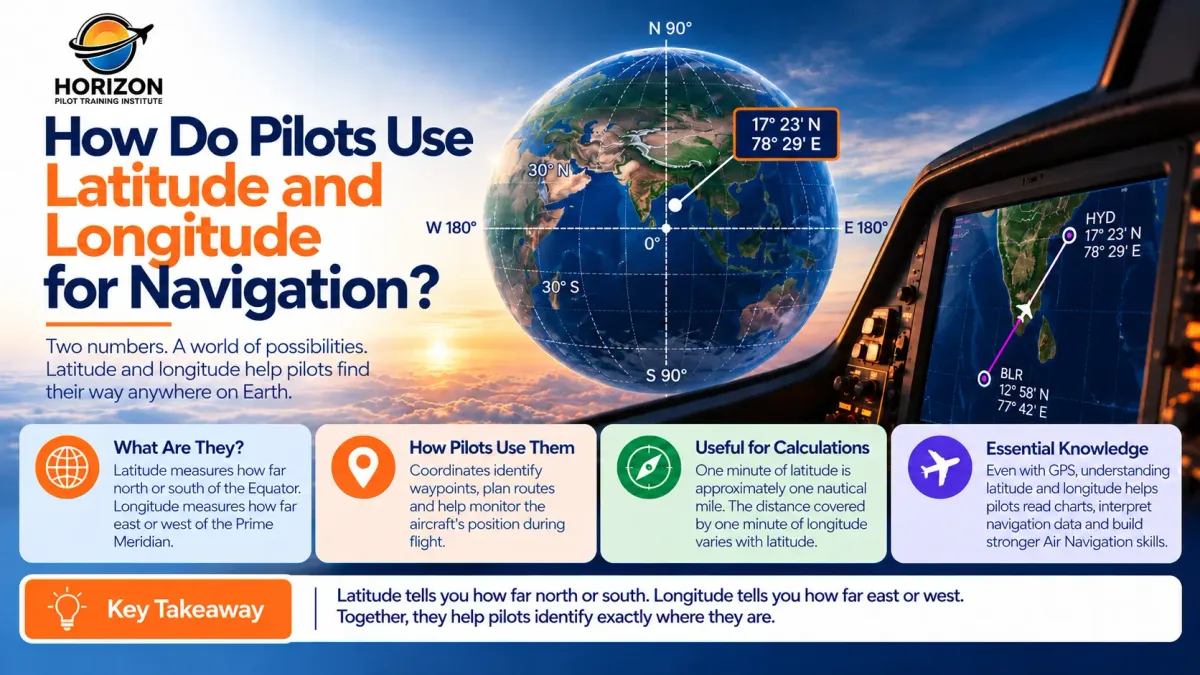
Latitude and Longitude in Aviation Explained
Imagine flying over the ocean with no roads, cities or landmarks in sight. How does a pilot know exactly where the aircraft is?
The answer lies partly in latitude and longitude, a geographic coordinate system that helps identify locations anywhere on Earth.
What Are Latitude and Longitude in Aviation?
Latitude and longitude are coordinates used to identify geographic positions.
Latitude measures how far north or south a location is from the Equator, ranging from 0° to 90°.
Longitude measures how far east or west a location is from the Prime Meridian, ranging from 0° to 180°.
Together, these coordinates identify a specific location on Earth's surface.
How Do Pilots Use Coordinates During Flight?
Pilots use latitude and longitude to identify waypoints, plan routes and monitor aircraft position.
Modern navigation systems, including GPS/GNSS and flight management systems, use geographic coordinates to determine positions and help guide aircraft along planned routes.
For example, an aircraft flying from Hyderabad to Mumbai may follow a route containing several predefined waypoints. Each waypoint has geographic coordinates that help the navigation system identify its location.
The pilot can monitor the aircraft's progress between these points using the available navigation displays.
Why Are Coordinates Important Over Oceans?
When flying over large oceans, familiar ground landmarks may not be available.
Latitude and longitude provide a consistent way to identify positions regardless of the surrounding terrain.
For example, a position written as:
15°30′N, 75°20′E
means 15 degrees 30 minutes north of the Equator and 75 degrees 20 minutes east of the Prime Meridian.
These coordinates can be used to identify a geographic position on a chart or within a navigation system.
How Are Coordinates Related to Distance?
Latitude and longitude are also useful in navigation calculations.
One minute of latitude corresponds to approximately one nautical mile along a meridian.
For example, the distance between 15°00′N and 16°00′N along the same meridian is approximately 60 nautical miles.
However, one minute of longitude does not represent the same distance everywhere. Its ground distance decreases as latitude increases.
This distinction is important when calculating distances on navigation charts.
Why Should Student Pilots Learn Latitude and Longitude?
Even with modern GPS technology, understanding coordinates helps student pilots interpret navigation charts, identify waypoints and understand how aircraft positions are represented.
It also builds a foundation for learning route planning, distance calculations and navigation systems.
The principle is simple:
Latitude tells you how far north or south. Longitude tells you how far east or west. Together, they help identify where you are.
For aspiring pilots, understanding these coordinates is an essential step towards developing stronger Air Navigation knowledge.


